
Alta Via 1 - Trekking in the Dolomites
Includes 1:25,000 Map Booklet
Cicerone Press Limited · Print & ebook · July 30, 2022
Guidebook with separate 1:25,000 map booklet to Alta Via 1, a long-distance trail through the heart of the Dolomites in northeastern Italy.
We earn from qualifying purchases.
- Who it’s for
- Plan Alta Via 1 with stage guidance, route maps, elevation profiles, and transport exits.
- Themes
- Trekking in the Dolomites, Hut-to-hut trekking, Route maps and navigation
- Genres
- Hiking & Walking, Italy Travel, Hiking
Nearest books
Matched by what the books are about, then ordered by what their readers also loved.
 Rick Steves ItalyRick Steves47% matchShares Italy Travel
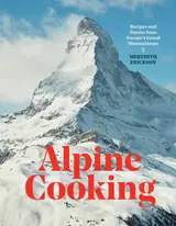 Alpine CookingMeredith Erickson44% match
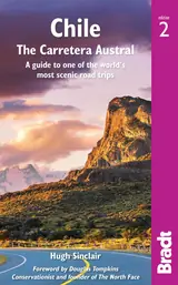 Chile: the Carretera AustralHugh Sinclair44% match
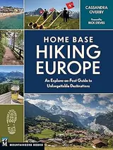 Home Base Hiking EuropeCassandra Overby43% matchShares Hiking & Walking and Hiking
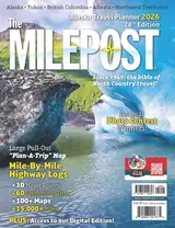 The Milepost 2026Stacey Quimby, Morris Communications39% match
 The Pilgrimage Road to SantiagoDavid M. Gitlitz, Linda Kay Davidson39% matchShares Hiking & Walking
 The Complete Italian CookbookManuela Anelli Mazzocco39% match
 Colorado's FourteenersGerry Roach39% matchShares Hiking
For younger readers: Roberto's Trip to the Top, The Big Book of Climbing, Hike It
Start with three books, and this one can be the first.
Members get a new edition every morning: a route out from their books to essays, research and talks, with the reason for each.
Start with this bookAbout this book
Guidebook with separate 1:25,000 map booklet to Alta Via 1, a long-distance trail through the heart of the Dolomites in northeastern Italy.
Continue reading
With fully waymarked paths, moderately graded terrain and hut-to-hut accommodation, AV1 is an ideal introduction to trekking in the Dolomites. - Includes separate map booklet featuring 1:25,000 Kompass mapping for the entire AV1 route - Totalling 72 miles (115km) in length, AV1 is usually walked in 11 daily stages of 4–9 miles (6–14km) - Clear route descriptions with 1:75,000 maps and elevation profiles, easier path variants, exit routes to reach public transport, and side-routes to explore nearby summits and points of interest - Starting from Lago di Braies, the north–south route passes close to Cortina d'Ampezzo and Agordo, and finishes at La Pissa, a short bus-ride from Belluno - Advice on four- or five-day sections of the route for walkers who prefer not to walk AV1 in its entirety - Suitable for beginner trekkers with reasonable fitness - GPX files available for download
Alta Via 1 Route
Plan Alta Via 1 with stage guidance, route maps, elevation profiles, and transport exits.
Come here for
- Clear route descriptions with 1:75,000 maps and elevation profiles
- Easier path variants, transport exits, and nearby summit side-routes
Expect
- A separate 1:25,000 map booklet covering the entire route
- Advice for four- or five-day sections
Where it sits
| Hiking | 71% |
|---|---|
| Hiking & Walking | 58% |
| Italy Travel | 57% |
Percentages are BookFrontier’s reading of the book.
Publisher categories
- Hiking
- Italy Travel
- Authors
- Gillian Price
- Publisher
- Cicerone Press Limited
- Published
- July 30, 2022
- Format
- Print & ebook
- Theme
- Trekking in the Dolomites · Hut-to-hut trekking · Route maps and navigation
- Reading lane
- Hiking